This is the blog. Click here to go to the Zenopus Archives website.

Note: Many older posts on this blog are missing images, but can be viewed at the corresponding page in the Internet Archive

FEATURED POST

The Forgotten Smugglers' Cave: Index of Posts

An index of posts describing the Forgotten Smugglers' Cave, an adventure for Holmes Basic characters levels 2-4.                    ...

Showing posts with label Blackmoor. Show all posts

Friday, September 27, 2024

Blackmoor Week: Blackmoor Foundations (New Book)


Blackmoor Week is the week leading up to the anniversary of Dave Arneson's birthday on October 1st, which is designated Dave Arneson Game Day. Thanks to Havard at Havard's Blackmoor Blog, who is making a whole series of posts this week, for reminding me of this.

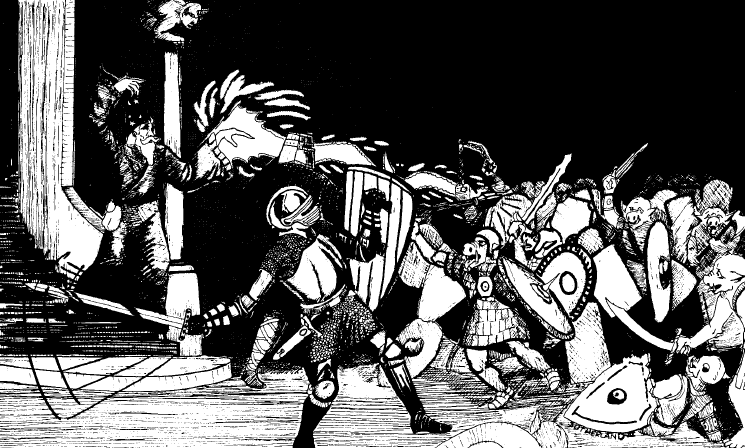
The Making of OD&D wasn't the only book of historical D&D documents to come out this year. The end of May also saw the release of Blackmoor Foundations, which is subtitled "The Early Fantasy RPG Works of David Arneson" (and can be purchased here). I recently ordered a copy, and while I'm only partway through, I thought I should highlight it in a post now for Blackmoor Week.

Here is an overview of Blackmoor Foundations:

---Paperback with glossy cover, 103 pages in length, and includes approximately 30 original documents including maps & letters, some of which are multiple typed pages in length including one ("Return to Black Moor") that is 15 (!) pages long.

---Nicely laid out with commentary by Griffith Morgan, the director of the Secrets of Blackmoor documentary, on the lefthand pages in a very readable san-serif font, and with the images of the documents on the right. I like this format for presenting these types of documents; it makes makes reading the notes while looking at the document very easy.

---Also credited for consultation are the "Northern Marches Historical Society", which among others includes D.H. Boggs, who has been presenting Blackmoor research for years over at the Hidden at Shadows blog.

---The publisher's product page here has a table of contents and even a complete flip-through of the book.

---There are two lengthy reports of delves into Blackmoor Dungeon, "The Dungeons of Black Moore Castle" (5 typed pages) and "Into the Dungeons of Black Moor Castle and Back" (6 typed pages). These look interesting but are very dense and I haven't read through them fully yet.

---For actual use in gameplay, it could serve as a supplement to Judge's Guild First Fantasy Campaign (1977), which was the original publication sharing Arneson's notes about Blackmoor, but which sadly remains out of print. For example, while the FFC has a map of Blackmoor town, the Blackmoor Foundations has a "Blackmoor Surrounding Landscape Map" that shows more of the immediate surrounding area, laid out in hexes.

---In all, I applaud the publisher & Arneson estate for making these historical documents directly available to the public.

Blackmoor Foundations can be ordered for $39.95 via the publisher's page (linked above) or via Amazon where it is currently on sale for $32.75:

Blackmoor Foundations


Friday, October 26, 2018

Locations for the Tomb of Horrors on the Great Kingdom Map


Promo image of the deluxe Art & Arcana from Amazon


"THE TOMB OF HORRORS"


Possible locations:

The highest hill in the Egg of Coot
An island lying 100 miles east of Blackmoor
In the great desert west of the Wild Coast
On the border between the Paynim Kingdom and Perrunland
At the Eastern edge of the Duchy of Geoff
In a swamp somewhere in the Wild Coast

These suggested locations for the Tomb of Horrors come from the original version of the adventur not the 1978 monochrome-colored module  but an even earlier iteration that was produced in 1975 for running as a tournament at Origins I in Baltimore, Maryland. This version is finally available as an extra included with the "special edition" of the new D&D art book Art & Arcana. You can see its cover in the promo image above; it's the small beige booklet featuring the original artwork by Tracy Lesch of the infamous Green Devil Face, which was later memorably rendered in color on the back of the 1981 reprint. Given its early date, it's a purely OD&D version of the tomb and is a great addition to the meager assortment of "TSR" adventures for OD&D.

These original suggested locations fit well with the "Great Kingdom" (early World of Greyhawk) map that I've discussed in previous posts such as Megarry's copy of the Great Kingdom Map, and suggest that Gygax may have been using this map for Greyhawk at the time. For reference, here is the map image 


On this map, the Egg of Coot lies in the center north, with hills in the northern region of the realm to possibly house "the highest hill". Blackmoor is to the south on the coast of the Great Bay, with plenty of space for an island "lying 100 miles east" in the bay, or depending on the scale, past the island kingdoms of the "Sea". To the west and southwest of Blackmoor, the Paynim Kingdom borders on Perrunland. Much further to the south lies the Duchy of Geoff, the eastern edge of which borders on the Kingdom of Faraz (not mentioned in the Tomb). Only the twice-mentioned Wild Coast is missing from this map, but the "great desert west of the Wild Coast" may be the Sea of Dust, suggesting the Wild Coast is to the south where the coast past of Keoland.

In the published version of Tomb of Horrors, the suggested locations were changed to:


The highest hill on the Plains of luz
An island (unmapped) In the Nyr Dyv
In the Bright Desert
At the western border of the Duchy of Geoff
Somewhere in the Vast Swamp south of Sundi
On an island beyond the realm of the Sea Barons

These revised locations correspond more closely to the published World of Greyhawk, although note that they were suggested in 1978, which was still several years before the World of Greyhawk Folio was first published in 1980.

The Egg of Coot was changed to "the Plain of Iuz"; Iuz occupies a somewhat similar north-central location in published Greyhawk and has "the Howling Hills" to the north.

The second entry, the island, was relocated to an unmapped island in Nyr Dyv, and second island was added "beyond the realms of the Sea Barons", which is closer in spirit to the island to the east of Blackmoor, particularly if the islands shown on the Great Kingdom map were an early version of the Sea Barons.

The desert was changed to "the Bright Desert", which on the published Greyhawk map is to to the east, rather than west, of the Wild Coast across the Woolly Bay. The "great" bit is dropped, presumably because the Bright Desert is much smaller than the Sea of Dust.

The eastern border of Geoff was changed to the western, presumably because that borders the great Crystalmist mountain range.

The swamp location was changed to "south of the Sundi", which means the Vast Swamp south of the County of Sunndi (member of the Iron League) on the Darlene map.

Finally, the suggestion of the border of Paynim/Perrenland was completely removed. In the Darlene map, the Plains of the Paynims no longer directly borders Perrenland; there are several new kingdoms between — Tusmit, Ket.

When the World of Greyhawk folio was finally published in 1980, the true location of the Tomb was finally revealed as being in the Vast Swamp:

There are many tales and legends concerning this area, but the most likely is that of the TOMB OF HORRORS (ADVANCED DUNGEONS & DRAONGS MODULE S1), the lost burial place of a lich who once ruled the morass and beyond into the cockscomb of Tilvanot. (a peninsula in the shape of a rooster's comb).

And then the expanded 1983 Word of Greyhawk boxed set further fixed the location as "probably" in "the heart of the Vast Swamp, in hex K2-97".

Thursday, February 2, 2017

Megarry's Copy of the Great Kingdom Map

Dave Megarry's Copy of the Great Kingdom Map


Above is a scan of a map from the early '70s showing Blackmoor and the Great Kingdom. This copy was recently uncovered by Dave Megarry, creator of the Dungeon boardgame, and a player in Dave Arneson's original campaign. Thanks to the Secrets of Blackmoor documentary (who will be posting the map on their FB page) and Dan at Hidden in Shadows I have the opportunity to take a look at this version here. Update: Dan has made a related post over here.

I've written before about another version of this map. Back in 2014, Jon Peterson gave us a glimpse of it in his video, a "History of D&D in 12 Treasures", where he labeled the map the 1971 Great Kingdom Map. Based on the video, I wrote a post titled "The Land of the Great Kingdom and Environs" (quoting the original D&D preface), where I noted similarities to the setting as finally published in the 1980 World of Greyhawk Folio (these notes are repeated below). I also back-annotated the details from the 1971 map to the original, more artistic Great Kingdom map published in Domesday Book #9 and reprinted in Jon's book, Playing at the World. Also see the even earlier post, "The Weird Enclave of Blackmoor".

Megarry's copy gives us a clearer view of the map than the glimpses in Jon's video. Each clearly originates from the same source, but Megarry's has some additional writing in colored pen. Much of it is just to darken the lines and/or writing, but there is at least one addition to the details, noted below.

Here are the features I couldn't see on the version in the "12 Treasures" video:

Keoland: This is to the southwest of the the Nir Div (later Nyr Dyv), as in the WoG Folio (1980), which notes that it was "the first major kingdom to be established in the Flanaess". Grodog's Greyhawk notes that Keoland was named for Tom Keogh, who Gygax elsewhere mentioned as a friend from his teen years. In Quag Keep, Chapter 5 there is a Keoland (once called Koeland) to the southwest of Greyhawk City.  It is mentioned that Keoland has "three tributaries of size feeding the main stream" (which may be called the Vold), which fits the map above showing three waterways running north in the Keoland area to join a larger river.


Eastern Ocean: This was "Western Ocean" on the Domesday Book map, but since it's to the east of the continent the revised name makes sense.

Nomads: This is written twice just to the north of the Dry Steppes and south of the Paynims. These possibly became the Tiger and Wolf Nomads in the published setting, although those groups are much further north. Another possibility is Ull, which is in a similar position relative to the Paynims and the Dry Steppes in the published setting, and is described as a "strong tribal clan of the Paynim nomads". Quag Keep mentions the Nomad Raiders of Lar who venture into the Dry Steppes, which fits with this map having the Nomads right next to the Dry Steppes. 

Contested Area: This label is south of the Gran Duchy of Urnst, west of the Kingdom of Catmelun, and east of Keoland. If Catmelun is Nyrond (see the earlier notes below), this might be analogous to the County of Urnst, which in the WoG Folio is an area fought over by the Gran Duchy of Urnst and Nyrond. Dan at Hidden in Shadows suggests this area might be what became the Wild Coast, which I agree is another possibility. It's relatively close to Greyhawk as in the WoG Folio, which says that "Portions of the area have been under the control of Celene, the Prince of Ulek, the Gynarch of Hardby, and the Free City of Greyhawk at various times" - certainly a "contested area". The name also predates the Folio, as the Wild Coast is mentioned once in Quag Keep, in a description of a battle between a demon and a dragon "from Blackmoor, out over Great Bay, down to the Wild Coast" (chapter 3). Looking at the map above, there is a great deal of territory between the Great Bay and the Contested Area; it's possible Norton was using the term simply to refer to the entire eastern coast.

The Great Kingdom: Visible on the "12 Treasures" map, but here we can more clearly see the 18 regions of the Great Kingdom, plus a "Royal Demense" [sic] in the center. The WoG Folio refers to the "Royal Demense surrounding the capital" as part of the area of authority of the Overking. The Domesday Book version of the map has an asterisk in this region, just south of the lake and possibly indicating the capital. It's situated a bit like Rauxes, the capital in the Folio, which is near where two rivers come together in a "V", but without a lake. Over in a sister post on Hidden in Shadows, Dave Meggary suggests that "the numbered areas were districts within the Kingdom which had their own Dukes and such". Some of these areas may have become the former holdings of the Great Kingdom noted in the Folio, including the nearly autonomous North and South Provinces, the Prelacy of Almor, the See of Medegia, the several member states of the Iron League, and possibly even Bone March.

Kingdom of Botulia: This is another island nation, near the Duchy of Maritz (see below). I can't find any names similar to "Botulia" anywhere else. These two nations perhaps became the island nations of the published setting: the Sea Barons and the Spindrift Isles.

Egg of Coot: On this map this region has an addition in blue marker: an 'X' labelled "Capitol". There's an asterisk-looking mark near the "F" in "OF", which could be another city, but there's no other label.

County of Hither Body (?): This region is east of the Hold of Iron Hand, northwest of the Egg of Coot. I'm not sure about that last word. In Quag Keep, there is a mention of the Hither Hills (thanks to Timrod's Quag Keep Companion for this info), which makes sense as the area is surrounded by hills. 

In view of these, I've updated the annotations on the Domesday Book Great Kingdom map:

Great Kingdom Map from Domesday Book #9, annotated in view of the 1971 map


For reference, and ease in reading, here the notes from my previous post:

Perunland is between the mountains to the northwest of Nir Dyv lake, as with Perrenland in the published Greyhawk map. 

A Paynim Kingdom is further to the northwest, south of the Far Ocean. In the published Greyhawk this becomes the Plains of the Paynims, south of the Dramidj Ocean.

The Hold of Iron Hand, north of the Paynim Kingdom on the Great Kingdom map, likely became the Hold of Stonefist. In published Greyhawk it is not anywhere near the Paynims, instead being at the western base of a northwestern peninsula in the same position relative to the Barbarian Kingdoms. Gygax seems to have split the northern areas of his Great Kingdom map, putting the the Hold and the Barbarian kingdoms on a great peninsula to the northeast, and leaving Perrenland, the Paynims and Blackmoor in the northwest.

A Grand Duchy of Urnst is to the immediate southeast of Nir Dyv lake, as in the published World of Greyhawk. A Kingdom of Catmelun is to the southwest of this, possibly where the Kingdom of Nyrond is in the published version.

A Grand Duchy of Geoff is to the west near the mountains, as in published Greyhawk.

Where the City of Greyhawk should be, there's C. of Yerocundy [sp?] and to the west, a Kingdom of Faraz. There is the possibility that these two were combined to form the Kingdom of Furyondy, which in published Greyhawk is to the west of the lake like Faraz.

Interestingly, Andre Norton's 1978 Greyhawk novel, Quag Keep, uses similar but not identical names for two kingdoms: 

"We shall have Yerocunby and Faraaz facing us at the border. But then the river will lead us straight into the mountains" (Chapter 6).

A Duchy of Maritz [sp?] also appears as an island on the Great Kingdom map.

Quag Keep further mentions:

"In addition he saw a dozen of these silver, halfmoon circles coined in Faraaz, and two of the mother-of-pearl discs incised with the fierce head of a sea-serpent which came from the island Duchy of Maritiz" (Chapter 3)

This warrants a closer look at the geography mentioned in Quag Keep versus the Great Kingdom map. Andre Norton consulted with Gygax in writing Quag Keep so she possibly saw an earlier version of Greyhawk using these names.

-Neron March (possibly "Nekon") might possibly be a predecessor of "Gran March". 

-In the comments Jon mentions Walworth north of the lake and that In published Greyhawk The Shield Lands appear in the same location and are ruled by the Earl of Walworth. In the video, Jon mentions that Gygax was named the Earl of Walworth in Domesday Book #2, and Walworth represents his holdings in the game (and is also the name of the county that Lake Geneva is in, in Wisconsin).

-I left out material from the map in the video that I couldn't read, and several small areas around Blackmoor that don't seem to correspond to anything significant: March Slove, County of Celate and County of Stabilny

Note: I have moderation set up for comments made two days after the initial post. This reduces spam comments. So if you make a post it won't appear right away, but as soon as I get a chance to check the pending comment queue I will approve it and then it will appear.

See the following related posts:

Tuesday, October 4, 2016

Gygaxian Orc Tribes


Fighting Man, Magic-User and Cleric take on dungeon orcs. By David Sutherland III.


Gary Gygax on the orc tribes of Castle Greyhawk, EnworldQ&A 2/2/04:
"The orcs in the dungeon were of two separate tribes, but I have forgotten the names I gave them. As near as I can recollect, one was the Grinning Skull and the other was the Bloody Axe. They were all cut down or made into vassals by Robilar and Terik, with a good deal of assistance from Tenser."

Chronology of Orc Tribes in Gygaxian D&D:


Lord of the Rings: Tolkien is, of course, the original source of orcs and their tribes. Aragorn refers to Saruman's Isengarders as "Orcs of the White Hand" (TT, Bk 1, Ch 2) after seeing shields with a
"small white hand in the centre of a black field" (TT, Bk 1, Ch 1). He notes that orcs "in the service of Barad-dur [Sauron's tower] use the sign of the Red Eye" (TT, Bk 1, Ch 1). Pippin and Merry later see Mordor orcs with "a red eye painted on their shields" (TT, Bk 1, Ch 3). Also called the Evil Eye in at least two instances; for example, "One [orc-helmet] fitted Frodo well enough, a black cap with iron rim, and iron hoops covered with leather upon which the Evil Eye was painted in red above the beaklike nost-guard" (RoTK, Bk 2, Ch 1). There is at least one further group; In Cirith Ungol, Sam notices two liveries, "one marked by the Red Eye, the other by a Moon disfigured with a ghastly face of death" (RotK, Bk 2, Ch 1). The Moon device is that of the Witch-King, ruler of Minas Morgul, formerly the Tower of the Moon.


Chainmail (1971): The names of five tribes are given, all based on Tolkien:

  • Orcs of the Red Eye
  • Orcs of Mordor
  • Orcs of the Mountains
  • Orcs of the White Hand
  • Isengarders
These are from the 2nd print (1972), but are presumably also in the 1st. They were removed from later printings along with other Tolkien references. The list is duplicative because in the Lord of the Rings, the Orcs of the Red Eye are the same as the Orcs of Mordor, and the Orcs of the White Hand are Isengarders. The Orcs of the Red Eye and White Hand also appeared in Patt's earlier Rules for Middle Earth (The Courier, 1970). Falconer pointed out that Arneson used these same five names, as seen in the First Fantasy Campaign (1977, Judges Guild).

Battle of the Brown Hills (pg 8-10 of the Wargamer's Newsletter #116, November 1971):

In this article, Gygax describes a fantasy battle between the forces of Law and Chaos, played using the Chainmail rules. Notably, the forces of Chaos include three tribes: Orcs of the Mountains (wielding sword & shield or bows), Orcs of the Vile Rune (wielding sword & shield) and Orcs of the Longspear (presumably wielding long spears). We can surmise shields would feature each tribe's device.

OD&D Vol 2 (1st print, 1974): "the number of different tribes of Orcs can be as varied as desired, basing the decision on Tolkien or random chance". No tribe names are given. The reference to "Tolkien or random chance" was deleted in later printings.


Scruby Fantasy 30mm minis (1975): Per Gygax on Enworld (10/8/07), "Jack Scruby began casting orcs, so we had real miniatures for them -- the Orcs of the Vile Rune whose symbol was a fist with a raised digit."

Holmes (July 1977): "There are many tribes or nations of orcs".


Monster Manual (Dec 1977): Here we get Gygaxian tribe names, including: 

  • Vile Rune (as seen previously in the Battle for the Brown Hills)
  • Bloody Head (perhaps the actual name for Grinning Skull?)
  • Death Moon (perhaps inspired by the Moon device of Minas Morgul?)
  • Broken Bone
  • Evil Eye (perhaps an update of Red Eye?)
  • Leprous Hand (perhaps an update of White Hand?)
  • Rotting Eye
  • Dripping Blade (perhaps the actual name for Bloody Axe?)
Gone are the names directly from Tolkien, but he sticks to a similar two-word style.

Gygax further notes that a "standard is always present where the tribal chief is" and "Their garments are tribal colors, as are shield devices or trim".

Dungeon Masters Guide (Aug 1979): This introduces a major new facet of humanoid tribes, including orcs, that departs from Tolkien: shamans & witch doctors (pg 40). These became a standard part of humanoid tribes, as shown by the citation from WG4 below.

B2 Keep on the Borderlands (1979): In the Caves of Chaos, there are two rival orc tribes in Caves B & C. This is the only type of humanoid having two different groups. The tribe in Cave B decorates its cave entrance with "cheerful greetings" - heads and skulls placed in niches in a wall - perhaps a reference to the Grinning Skull/Bloody Head/Bloody Skull tribe. And Falconer notes that the leader of Cave C wields a magic hand axe - a possible reference to the Bloody Axe tribe. So the two tribes of the Caves of Chaos are in some ways analogous to the two tribes of the Greyhawk Castle dungeons. 


World of Greyhawk Folio (1980): Includes a series of shield devices for various kingdoms, including a grinning human skull for the "Orcs of the Pomarj" (the dominant humanoid of the Pomarj). This device was retained in the World of Greyhawk boxed set (1983). It's possible that Gygax was remembering this device when he mentioned "Grinning Skull" as the possible name of the Greyhawk Castle tribe.


Orcs of the Pomarj


Developments from Stonefist to South Province (Dragon #57, Jan 1982): "Three major groups vie for control of the whole of the Bone March. The most powerful group, until the Battle of the Loftwood, was the humanoid group under the orcs of the Vile Rune. Now paramount are the orcs of the Death Moon tribe. Both groups have considerable numbers of various sorts of humanoids serving them. Both are also led by half-orcs and assisted by evil humans. The third power group is a force of ogres and gnolls based in the hills at the head of the Teesar Torrent" (pg 15).

The Gods of the Orcs (Dragon #62, June 1982): "The division of orcs into separate tribes (Evil Eye, Death Moon, Broken Bone, etc.) is usually made along cult lines. The tribal symbol is the holy symbol of the orcish god the tribe holds as its patron" (pg 29). "Luthic’s worship is one of the few that allow male and female orcs to become clerics ... Orcs in her tribe (Vile Rune) generally dwell underground, and seem to commit fewer raids against other creatures, though they are especially fierce if their lair is threatened" (pg 32). This is an article by Roger E. Moore detailing the gods of the Orcs other than Gruumsh, who appeared in Deities & Demigods (1980). Gygax later incorporated the article into Unearthed Arcana (1985) with credit to Moore.

WG4 Forgotten Temple of Tharizdun (1982): "These are Orcs of the Rotting Eye tribe, belonging to the clan of the Jagged Knife. The standard is a huge, glaive like knife blade with a serrated edge ... colored a rust red and atop a long shaft, beneath it being the circular target depicting a rotting eye colored yellow green and red. This symbol is repeated on the shields of the soldiers, with the jagged-bladed knife seeming to grow out of the rotting eye device. Guards and ranking figures wear dull red clothing. The sub-chief, shaman, and chief also have cloaks of yellowish green, the chief‘s being striped with red, the shaman’s merely bordered with that color" (pg 8). This module is set in the Yatil Mountains of Greyhawk.


Castle Zagyg (2008): The first dungeon level ("Storerooms") has a Bloody Skull orc tribe. Bloody Skull may have been the actual name, or was used to replace Bloody Head as the name was already published in the Monster Manual. Update: I also checked the earlier Yggsburgh hardcover (2005). There are some orc encounters, but no mention of tribes.

Wednesday, January 22, 2014

The Land of the Great Kingdom and Environs

If you haven't seen it yet, check out the video by Jon Peterson (author of Playing at the World) highlighting some awesome pre-D&D treasures from his collection:

"History of D&D in 12 Treasures"

Item #5 is a map, labeled in the video as "Great Kingdom Map, Gary Gygax, 1971, Territories of the Great Kingdom". In the accompanying post he further describes it as  "showing Blackmoor and other Castle & Crusade Society holdings". In the video Jon gives us several glimpses of the map that show a number of familiar kingdom names from the published World of Greyhawk, 1980.


An earlier version of this map, originally published in Domesday Book #9, appeared in Jon's book in 2012. This map has some geographical features named but is mostly missing the names of kingdoms. However, at the time I noticed that Dave Arneson's hand drawn map of Blackmoor from the First Fantasy Campaign (1977) matched a portion of the Great Kingdom Map. Combining the information from the two, I posted ("The Weird Enclave of Blackmoor") an annotated map with speculative locations of Blackmoor and Greyhawk:


Now, thanks to the glimpses of the "new" map that Jon has shown us in his video, I see that I was basically correct in the locations for Blackmoor, the Egg of Coot, the Duchy of Ten and The Great Kingdom, each of which is named in this map.

While the outlines and geographical features of the "new" Great Kingdom map are not identical to the previous one, they are close enough to roughly transpose the kingdom names back on to the mostly blank original map: 


Observations:

-Obviously, many changes were made when this world was later adapted as the World of Greyhawk in 1980, but it is striking how many familiar names appear in familiar locations. 

-Perunland is between the mountains to the northwest of Nir Dyv lake, as with Perrenland in the published Greyhawk map. 

-A Paynim Kingdom is further to the northwest, south of the Far Ocean. In the published Greyhawk this becomes the Plains of the Paynims, south of the Dramidj Ocean.

-The Hold of Iron Hand, north of the Paynim Kingdom on the Great Kingdom map, likely became the Hold of Stonefist. In published Greyhawk it is not anywhere near the Paynims, instead being at the western base of a northwestern peninsula in the same position relative to the Barbarian Kingdoms. Gygax seems to have split the northern areas of his Great Kingdom map, putting the the Hold and the Barbarian kingdoms on a great peninsula to the northeast, and leaving Perrenland, the Paynims and Blackmoor in the northwest.

-A Grand Duchy of Urnst is to the immediate southeast of Nir Dyv lake, as in the published World of Greyhawk. A Kingdom of Catmelun is to the southwest of this, possibly where the Kingdom of Nyrond is in the published version.

-A Grand Duchy of Geoff is to the west near the mountains, as in published Greyhawk.

-Where the City of Greyhawk should be, there's C. of Yerocundy [sp?] and to the west, a Kingdom of Faraz. There is the possibility that these two were combined to form the Kingdom of Furyondy, which in published Greyhawk is to the west of the lake like Faraz.

Interestingly, Andre Norton's 1978 Greyhawk novel, Quag Keep, uses similar but not identical names for two kingdoms:
 
"We shall have Yerocunby and Faraaz facing us at the border. But then the river will lead us straight into the mountains" (Chapter 6). 

-A Duchy of Maritz [sp?] also appears as an island on the Great Kingdom map. 

Quag Keep further mentions:

"In addition he saw a dozen of these silver, halfmoon circles coined in Faraaz, and two of the mother-of-pearl discs incised with the fierce head of a sea-serpent which came from the island Duchy of Maritiz" (Chapter 3)

This warrants a closer look at the geography mentioned in Quag Keep versus the Great Kingdom map. Andre Norton consulted with Gygax in writing Quag Keep so she possibly saw an earlier version of Greyhawk using these names.

-Neron March (possibly "Nekon") might possibly be a predecessor of "Gran March".

-In the comments Jon mentions Walworth north of the lake and that In published Greyhawk The Shield Lands appear in the same location and are ruled by the Earl of Walworth. In the video, Jon mentions that Gygax was named the Earl of Walworth in Domesday Book #2, and Walworth represents his holdings in the game (and is also the name of the county that Lake Geneva is in, in Wisconsin).

-I left out material from the map in the video that I couldn't read, and several small areas around Blackmoor that don't seem to correspond to anything significant: March Slove, County of Celate and County of Stabilny

-The title of this post references the Foreword to the original D&D Set, also reprinted in Holmes Basic:

"From the map of the "land" of the "Great Kingdom" and environs - the territory of the C&C Society - Dave located a nice bog where to nest the weird enclave of "Blackmoor", a spot between the "Great Kingdom" and the fearsome "Egg of Coot"".

Saturday, October 19, 2013

The Giant Hogs of Greyhawk & Blackmoor Dungeons

In response to the Monster Table comparison yesterday, Teenage Visigoth commented that the Basic Set tables "should have kept the giant hogs". This refers to the 3rd level tables in OD&D and Greyhawk, which have an entry for Giant Hogs. This is a now mostly forgotten wandering monster, but was found in both Greyhawk and Blackmoor dungeons:

In Gygax's description of Castle Greyhawk in the Europa zine, Aug 1975, posted here, we learn, "The sixth [level] was a repeating maze with dozens of wild hogs (3 dice) in inconvenient spots, naturally backed up by appropriate numbers of Wereboars."

And in the First Fantasy Campaign (1977), Arneson has Giant Hogs in room 14 on level 5 of the Blackmoor Dungeons: "3 Giant Hogs: AC4, 4 [HD]/17 HTK."

The Hogs are not described anywhere else in the LBBs or Greyhawk, but would fall under "Large Insects or Animals" on page 20 of Monsters & Treasure, a highly variable group that includes all giant animals as well as dinosaurs. Number appearing is 2-16, and the rest of the stats are basically DM's choice: AC2-8, HD 2-20, Damage 2-4 d6. But the stats for Wereboars, which at HD 4+1 are tougher than Gygax or Arneson's Hogs, could be used as a guideline. There's also the Wild Boar in the Monster Manual, which is HD3+3, AC7, Damage 3-12. So we could come up with something like this:

Giant Hog

Move: 120 feet/turn
Hit Dice: 3-4
Armor Class: 7
Treasure Type: nil
Attacks: 1
Damage: 2-12

The Monster Manual also has a "Giant Boar", but they are prehistoric beasts with 6 HD, much larger than the original Greyhawk Hogs.

For an even better take on dungeon hogzillas, see the Purple Pigs at the Rended Press. This creature was inspired by an entry on a 'corrected' 1st print Holmes table.

(This post adapted from some of my posts in a Giant Hogs thread on OD&D Discussion)